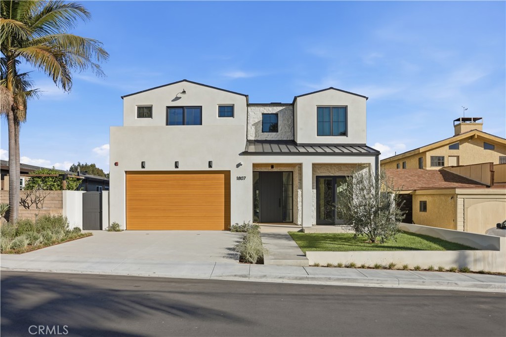
On part of Dominguez Street, the grass homeowners mow and the fences they built go past the edge of their property. The city's land runs about six feet beyond the sidewalk there. A planning meeting for a bike trail made that public this fall. A typical Torrance home purchase can close without the buyer ever learning where that line is. A standard title policy, a disclosure packet and a walk-through all look at the house. None of them is built to tell you whether the front fence sits on your lot.
That makes the front yard one of the less obvious things to check in a Torrance sale. The same issue can come up on many streets in the city.
Torrance is in the early stages of planning the Multi-Use Active Transit Trail. It would link the Mary K. Giordano Regional Transit Center with Downtown Torrance. One concept starts at the transit center, crosses Crenshaw Boulevard and heads east on Dominguez Street. From there it follows the road south as it becomes Sartori Avenue and Border Avenue, ending at Torrance Boulevard in Old Torrance.
The city's first community workshop took place October 13, 2026, at the transit center. About 42 people attended, along with five city representatives. Attendees voted on alignment options for parts of the route.
The Daily Breeze reported the detail that matters most for homeowners. Torrance Planning Manager Oscar Martinez told the paper the project would not need to buy any property, because city-owned land extends six feet beyond the sidewalk. Many properties along the route have lawns or fences right up to the sidewalk. The Daily Breeze reported that the city would be within its rights to use those six feet for a sidewalk, which would leave room for street parking and a bike lane. According to the same report, some residents at the meeting were worried about losing parts of what they had believed was their property.
Attendees still voted heavily for Class II bike lanes, which are separate lanes that would widen the roadway by about five feet. They also chose modern amenities such as benches and playground equipment over simple exercise stations. Martinez said there are no firm plans or cost estimates yet, and the city is still gauging community support.
The six-foot figure describes this corridor. The meeting is still useful well beyond Dominguez Street because it showed people that the edge of a yard and the edge of a lot can be in different places.
The city's parkway landscaping handout defines the parkway as the part of the public right-of-way between the curb or edge of the pavement and the property line. It may or may not include the sidewalk, street trees or streetlights. A separate city page says the public right-of-way "generally includes the area from your front property line to the property line across the street."
So the property line is often somewhere behind the curb, and on some streets behind the sidewalk too. The strip in front of it is public land that the homeowner looks after. Here's how the city's handout divides the responsibilities:
| Parkway question | What Torrance's handout says |
|---|---|
| Who maintains it | The private property owner, per Torrance Municipal Code Section 75.1.13 |
| Permit to landscape | Not required, though the city asks owners to contact Public Works Streetscape if work could damage street tree roots |
| Height limit for owner plantings | Not to exceed 18 inches, per TMC 75.1.6, not counting city street trees |
| Prohibited materials | Thorny plants, plus rocks, stones, pebbles, pavers, concrete, asphalt and brick |
| Street trees | Maintained by Public Works Streetscape |
| If city work disturbs owner improvements | The city will not restore them; restoration falls to the owner |
That last row matters most to a buyer. A paver walkway, a raised planter or a low wall along the sidewalk may look like part of the lot. If it sits in the parkway, it sits on land the city can work on, and the city's handout says it won't put back what it removes.
Building in that area is regulated as well. The city says construction in the public right-of-way is limited to licensed contractors. Its encroachment application procedure, revised July 1, 2025, asks for a sketch, proof of ownership and insurance naming the city. It also requires a separate Construction and Excavation permit before new structures go up in the right-of-way, followed by an inspection to confirm placement. The procedure lists an application fee and a Los Angeles County recordation charge. The city's FY 26/27 engineering fee schedule shows a different amount for a related line item, so check the current fee with Engineering before you budget. If you're thinking about a wider driveway, the FY 26/27 schedule lists residential driveway inspection at $583 per opening.
Most of a purchase depends on public records, and a property line on the ground doesn't show up in those records the way a lien does.
California's Department of Insurance explains the difference in its title insurance guide. A standard policy mainly covers title defects that a search of public records would find. An extended policy adds coverage for easements, encroachments and boundary conflicts that are not in the public record. Because the extended policy covers those off-record problems, the insurer will typically require a survey. The department adds that optional endorsements, including one for accuracy of boundaries, can be bought for an additional cost.
First American's consumer guide to title policies says the same thing from the insurer's side. A standard policy typically excludes matters a survey would reveal, including boundary issues and encroachments. Its comparison lists encroachments as potentially covered under extended or Eagle policies, subject to the policy terms.
The visible signs don't settle it either. San Mateo County's planning department cautions that "fence lines are not necessarily a good indicator of property lines" and points owners to a licensed land surveyor when the boundary is uncertain. That advice applies in Torrance too. A fence put up decades ago along the sidewalk can make a lot look six feet deeper than it is, and a standard policy may never ask whether it does.
The trail is still in planning. A separate project is already underway. The Metropolitan Water District is doing a $60 million rehabilitation of about 3.8 miles of the Sepulveda Feeder pipeline. The work starts along Van Ness Avenue in Torrance and runs south to Del Amo Boulevard and Western Avenue in Harbor Gateway, according to the Daily Breeze. Staging and excavation had already begun along Western Avenue. Construction was set to start in November, with close to a dozen lane closures planned over about eight months and completion targeted for June. MWD says water service will not be interrupted. It warns of possible parking restrictions, detours, sidewalk or bike-lane closures and round-the-clock work as needed.
Public agencies use the strip between the street and private lots for pipes, sidewalks and lanes. If you're buying near either route, it helps to know where your lot ends and what the project schedules are before you open escrow.
Sellers can use the same list. Knowing where the line is before you list means a buyer's surveyor won't be the first to find it.
Does the six-foot figure apply to every Torrance street? The figure comes from Martinez's comments to the Daily Breeze about the trail corridor along Dominguez Street. To find where the line falls on a particular lot, you need a survey of that lot.
Is the trail approved? No. The city has held one workshop. Martinez described the project as early stage, with no firm plans or cost estimates. Questions can go to the Community Development Department at 310-618-5990.
What does the city say about replanting a parkway? The city's handout says landscaping the parkway doesn't need a permit. Owner plantings may not exceed 18 inches, and hardscape and thorny plants aren't allowed.
This post is general information, not legal, title or financial advice. Confirm your own property lines, coverage and permits with a licensed surveyor, your title company and Torrance Engineering.
If you're buying or selling in Torrance and want to know where the lot really ends before escrow opens, Billings Beach Homes can help you line up the survey, the title questions and the city records early in the process. Give us a call and we'll go through it with you.
Compass
2141 Rosecrans Avenue, Suite 1120
El Segundo, CA 90245
Brook Billings | CA DRE# 01997704
Billings Beach Homes and Associates